Standard Drone Surveys
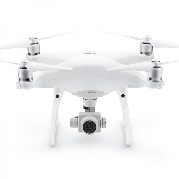
Our ‘Standard’ Drone Surveys services is performed using a Phantom 4 drone and smart ground control points. This service is ideal for the budget conscious client who does not require less than 50mm accuracy or image resolution above 20mp. Whilst our local service includes the below, we will travel anywhere for Drone Survey assignments.
- Drone Survey Brisbane
- Drone Survey Gold Coast
- Drone Survey Grafton (Northern NSW)
“A Smart, Safe, Efficient and Cost Effective Alternative to Traditional Surveying”
Our ‘Standard’ Drone Service
For ‘Standard’ Drone Surveys we use a Phantom 4 drone and smart ground control points. The 20mp imagery is later processed through photogrammetry software that can produce:
- Orthophotos,
- Digital elevation models,
- 3D modelling,
- Volume calculations,
- Point cloud generation,
- Slope direction,
- Angle calculations.
Conventional Outputs include:
- Surface LAS & CSV
- Vector DXF
- CAD DWG
- Raster ECW
Our ‘Standard Drone’
DRONE VERTICAL ORTHOPHOTO
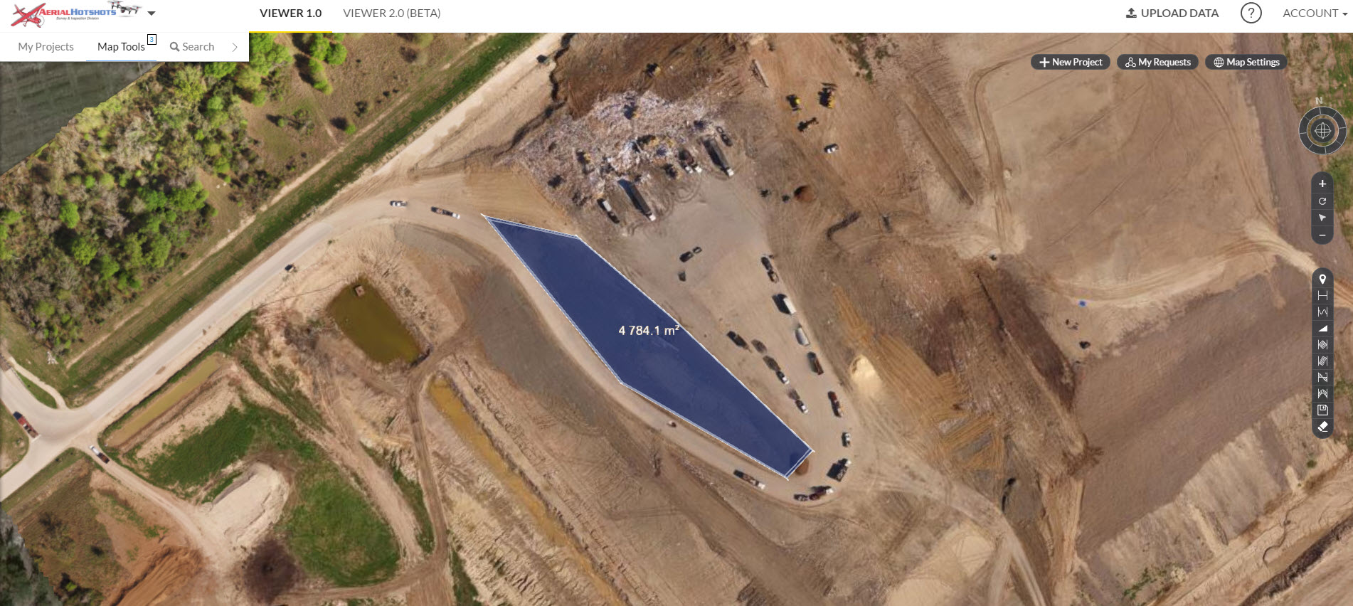
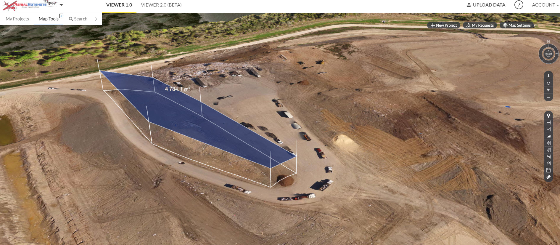
DATA INTERROGATION – CLOUD BASED SOFTWARE
View Data, Inspect, Visualise, Share
Using cloud based software our clients can access their data to:
- Visualise
- Measure
- Share & Collaborate
- Export in:
- JPEG
- TIFF
- DXF
- LAZ
- Data Backups
- Report Generation
A Screenshot of the Cloud Software Showing Volume Calculations
SUPPORT EQUIPMENT
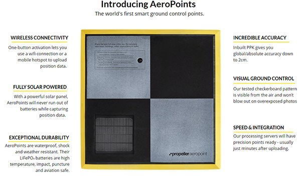
Aeropoints – Smart Ground Control
Agisoft Photogrammetry Software
Drone Benefits
- Efficient
- Cost Effective
- Faster Access to Data
- Cost Savings = Increased Surveys
- Reduces WPHS Risks
- No traversing unstable ground
- No contact with waste material
- Reduces Client Survey Consumables